It was time to head east again. We had burned up 4 of our 7 weeks for this road trip going from Toronto to Vancouver Island. With only three weeks to make our return trip, there was a decision to be made. Based on distance, time, and scenery, it was decided that the return route would be through the northern United States. This post covers Washington State, through Idaho and Montana into Yellowstone National Park.
To bring you up to date, here are the posts so far:
- Road Trip from Toronto to Winnipeg via Northern Ontario
- Canadian Prairies Road Trip: Drama in a Subtle Land
- British Columbia Road Trip Across the Rockies to Vancouver Island
- Travel Gives Me Hope: An Idaho Experience
If you have not been following this trip, I need to let you know that this is my annual trip with my husband. The rest of the year, my travels are solo.
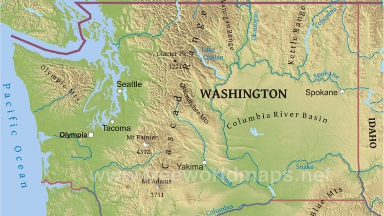
The Surprising Geography of Washington State
We started our return trip from the Vancouver Lower Mainland in the early afternoon, which was late for a driving day. We typically did most of our driving in the morning but this day we had a morning commitment. We left immediately after as we were eager to get traveling again. We had spent a full week in the Vancouver area.
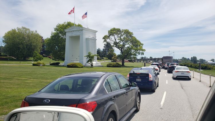
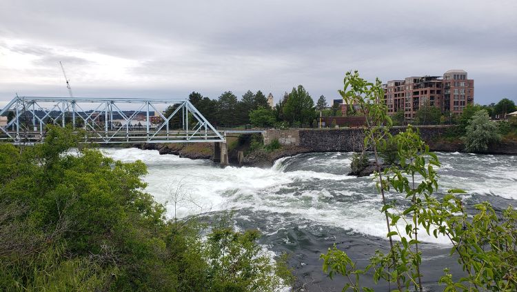
We crossed the border into the United States at the Peace Arch Border Crossing and got onto Highway 5, aiming for Seattle. Seattle was not our destination but our turning point to get onto the I-90, our choice given that we needed to make up for time lost earlier on the trip.
We reached the city at rush hour and it required patience. If I had been solo, I would have avoided this. But, with the help of Simon and Google Maps, we navigated multiple lane changes and exits to get onto the interstate and headed east across Washington State.
Geography cannot be truly understood until you experience it. A road trip is perfect for this.
In my mind, traveling Washington State would involve traveling successive mountain passes from the west to the east as one does in British Columbia. This is not the case. The interstate crosses the Cascade Mountains via the Snoqualmie Pass to reach the Columbia River Basin, a plateau, which takes up most of the northern part of the state.
The Cascade Mountains begin in Southern British Columbia and end in Northern California with an average elevation of 4,400 meters. Mount Rainier is the highest point but, thanks to the Snoqualmie Pass with a top elevation of 919 meters, crossing the range is not difficult.
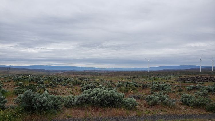
The Columbia River Basin, also known as the Columbia Plateau, reaches an elevation of 1,200 meters. Yet, it feels like sea level given the flatness of the land. It is semi-arid, featuring sage brush and grasslands.
It was the plateau that surprised me. It was like being on the prairies again with cattle grazing and some irrigated farmland. Yet, due north in Canada, one would still be in the mountains.
Geography dictates history, culture, economics, and more. To experience and understand geography is important. My understanding of geography shifted greatly on this trip.
Coeur d'Alene, Idaho to Yellowstone National Park
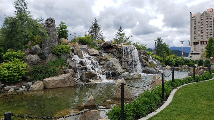
Following the I-90 out of Spokane we quickly arrived at Coeur d'Alene, a charming town with parks and shops that beckon tourists. It also attracts some people with extreme right positions. I was pleased to chat with the director of the Human Rights Education Institute to learn how they are trying to open dialogue between left and right to create a more inclusive community. To learn more, read Travel Gives Me Hope: An Idaho Experience.
Coeur d'Alene can certainly take more than a day to explore. Here are a few things the town has to offer.
- Lake Coeur d'Alene is one of the largest lakes in the state.
- McEuen Park is a large public space for walking, cycling, and events.
- Take a cruise on Lake Coeur d'Alene for a scenic view, Sunday brunch, or sunset dinners.
- Tubbs Hill has a hiking trail accessed from McEuen Park. It is an excellent place to watch a sunset.
- Shop Sherman Avenue. In 2016, the American Planning Association designated Sherman Avenue (the main street) as a “Great Street”.
- Museum of North Idaho provides a history of the area.
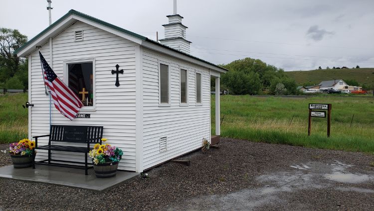
While we were making up time by taking the I-90, it didn't stop us from popping off the route to explore small towns along the way. Wallace was the first town we encountered promoting its historic downtown. It's situated in the Silver Valley mining district of the Idaho Panhandle, an area that produced more silver than any other district in the US. The town appears to thrive on tourism now. Nearby, there are a number of deserted mining communities.

After spending a night in Missoula, we moved further east to Livingston where we finally turned off the Interstate onto the 89 towards Gardiner and the north entrance to Yellowstone National Park. This is the only entrance that is typically open year round. This year, it was closed for a few weeks in June due to flooding.
More Adventure than Expected in Yellowstone National Park
We arrived at the North Entrance of Yellowstone around 3:30 pm and were informed that there had been a rockslide on the road. It had been cleared, so we were told that all should be good. There was no suggestion that there would be more trouble. There was.
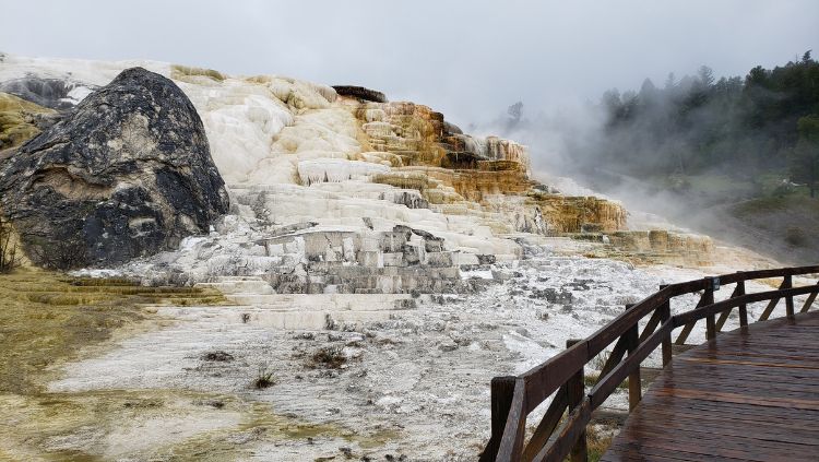
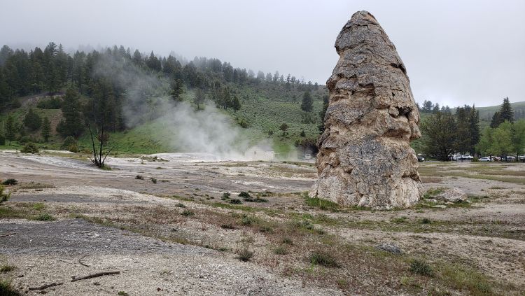
We stopped off to see Mammoth Hot Spring but didn't hike the area given that rain was pouring down. Instead, we headed south towards Fishing Bridge where we would spend the night.
It rained all night.
The forecast for the rest of the week was rain.
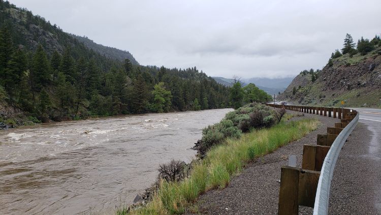
Sadly, we decided that there was little point in staying. We checked out, went to view the canyon, and then backtracked to get on Highway 14 east to Cody, Wyoming. Yellowstone Lake was gorgeous. The Shoshone River was gushing. The highway twisted tightly around mountains and passed through burned forests. It was a spectacular drive that demanded a lot of attention to the road. And the whole time we marveled that there was very little traffic.
We reached the east gate and there were a few cars milling around and park rangers but no one seemed to want us to stop, so on we went. When we reached an RV park to spend the night I was asked why we came to Cody. “Too much rain in Yellowstone,” I said. That's when I learned that they had closed the roads and the park entirely, and that roads were giving way. If felt like we had narrowly escaped what could have been very serious.
So, unfortunately, I don't have much I can share about Yellowstone National Park. Fortunately, it is a destination well covered online.